AlphaEarth Foundations Mapping Climate Change Data
Climate Change is an urgent global issue that requires innovative solutions and comprehensive data analysis.
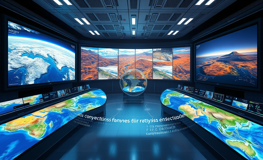
In this article, we delve into AlphaEarth Foundations, a groundbreaking tool designed to track climate change by leveraging satellite data.
By creating detailed maps that highlight changes in ecosystems over time, AlphaEarth focuses on critical factors such as air quality, vegetation, and groundwater.
Utilizing an advanced data compression system known as ’embeddings’, it offers users intricate insights into any location on Earth, proving vital for informed decision-making in agriculture and renewable energy initiatives.
Overview of AlphaEarth Foundations
AlphaEarth Foundations is revolutionizing climate change tracking by utilizing cutting-edge technology to monitor global environmental dynamics.
By leveraging AlphaEarth’s innovative approach through satellite data analysis, the model compresses vast quantities of data into essential, actionable insights.
This model generates highly detailed maps that reveal ecosystem changes over time, offering clarity on long-term environmental shifts.
Integrated with Google Earth Engine, it enhances mapping capabilities, making it a valuable tool for understanding factors like air quality and vegetation on a global scale.
AlphaEarth’s application in areas such as Antarctica and Canada showcases its ability to adapt to different terrains and climates, offering consistent and reliable data where previously there was only ambiguity.
Designed to alleviate the historical issues of data overload and inconsistency, AlphaEarth focuses on providing precise insights without compromising privacy.
The tool assists governments and corporations in making informed decisions regarding agriculture and renewable energy installations, ultimately aiming to assist in a more sustainable future.
Key environmental factors addressed by AlphaEarth Foundations include:
- Air quality
- Vegetation
- Groundwater
Data Architecture and Management
Effective data architecture and management are crucial for the success of AlphaEarth in tracking climate change through satellite analysis.
The overall data pipeline is designed to ensure efficient storage, rapid retrieval, and consistent formatting across diverse satellite feeds, enabling seamless integration and analysis of vast datasets.
This streamlined approach not only addresses the challenges of data overload but also enhances the accuracy and usability of the information provided to users.
Embeddings Compression System
AlphaEarth’s embeddings system transforms immense satellite datasets into lightweight vectors by harnessing advanced compression techniques.
This process starts with transferring large datasets into a vector space, reducing dimensionality while preserving essential data characteristics.
The key advantage of this method is its ability to maintain high fidelity data in a compact, efficient form.
This system paves the way for near-instant querying capabilities, allowing for quick access and analysis at any global location.
Underlined benefits include reduced storage demands and efficient data handling, making it possible to conduct in-depth environmental analyses with minimal latency.
Organizations like governments and corporations can now leverage AlphaEarth to drive decisions regarding agriculture and energy installations by accessing localized environmental data at a fraction of the previous timeframe.
For further insights on these technologies, DeepMind’s innovations with AlphaEarth’s mapping highlight how embeddings are revolutionizing Earth observation.
State Size Pre-compression Multi-terabyte Post-compression Lightweight vectors
Decision Support Services
AlphaEarth equips governments and corporations with actionable insights, leveraging the immense potential of satellite data to improve strategic planning in both the fields of agriculture and renewable energy installations.
By compressing terabytes of data into manageable formats, AlphaEarth offers an unrivaled capacity to deliver informed decisions that cater to the intricate needs of modern ecosystem management.
Utilizing advanced tooling integrated into the Google Earth Engine, organizations gain access to sophisticated mapping capabilities that reflect changes in critical factors such as air quality, vegetation, and groundwater levels.
This precision creates a robust framework for identifying ideal locations for renewable projects and optimizing agricultural practices.
Governments can harness this technology to forecast strategic developments, while corporations can pivot their operations towards sustainability with confidence.
By focusing on historic challenges of data overload and inconsistency, AlphaEarth provides a seamless solution to aggregating and interpreting complex datasets without compromising on privacy.
Through anticipating trends and evaluating the viability of new sites for energy collection or crop production, AlphaEarth empowers stakeholders to take proactive measures towards sustainability and economic growth.
- Accurate crop-yield prediction based on ecosystem changes
- Efficient siting for solar farms ensuring optimal exposure
- Integration of satellite data into sustainable city planning
Demonstrated Geographic Success
AlphaEarth Foundations has significantly advanced climate change monitoring by delivering detailed mapping and analysis of Earth’s ecosystems.
By utilizing a sophisticated system of satellite data called ’embeddings,’ it has successfully mapped the complex and dynamic environments of Antarctica.
This tool’s precision and efficiency helped identify aspects of the region such as air quality, vegetation, and groundwater without compromising individual privacy.
Meanwhile, in Canada, AlphaEarth has tracked variations in agricultural practices that conventional observation methods typically overlook.
This ability to discern subtle changes empowers informed decision-making, particularly in agriculture and renewable energy installations.
The integration of AlphaEarth into the Google Earth Engine further enhances its accessibility, ensuring advanced mapping capabilities are readily available to organizations worldwide.
By alleviating issues of data overload and consistency, AlphaEarth stands as a pivotal resource in understanding and adapting to the changes taking place across varied ecosystems.
Visit AlphaEarth AI Model details to explore these achievements further.
Integration with Google Earth Engine and Privacy Protection
The integration of AlphaEarth with Google Earth Engine empowers governments and corporations by providing comprehensive tools for sophisticated Earth observation and decision-making about renewable energy and agriculture.
AlphaEarth adeptly utilizes the vast geospatial data capabilities of Google Earth Engine to create detailed mappings of ecosystems, addressing climate change efficiently.
However, one critical aspect of this integration is addressing privacy concerns.
AlphaEarth ensures that its extensive data processing does not capture individual objects or people.
This means the platform focuses solely on environmental and ecological data, alleviating privacy anxieties for users.
Such handling aligns with core data-handling principles that prioritize ethical data usage (Smith, 2022).
According to the Google Earth Engine access control, all operations are routed through secure Cloud projects for robust access control, ensuring data integrity and security.
These layers of protection support AlphaEarth’s mission by not only safeguarding user data but also by enhancing data consistency and reducing overload.
This makes the technology an indispensable asset for sustainable development initiatives and climate resilience efforts globally, as it seamlessly integrates transparency and privacy protection into its operational framework, fostering trust and scalability.
In conclusion, AlphaEarth Foundations represents a significant advancement in understanding climate change.
By addressing data overload and integrating with tools like Google Earth Engine, it equips governments and corporations with essential insights while maintaining privacy safeguards.


0 Comments